


Navigating the Skies: HKUST’s Game-Changing Digital Twin

For many, sticking to familiar paths feels safe and comfortable. But not for the trailblazers at the Hong Kong University of Science and Technology (HKUST). They are not just thinking outside the box—they are pushing boundaries and aiming for the skies—quite literally.
At HKUST’s Low Altitude Economy Research Center (LAERC), researchers are revolutionizing the future of urban airspace to support HKSAR Government’s policy in promoting the low-altitude economy. Their mission? Harnessing the groundbreaking Digital Twin technology—a virtual replica of the physical world—to transform drone management, airspace control, and infrastructure monitoring.
Spearheaded by Professor Jack CHENG of the Department of Civil and Environmental Engineering, this innovative technology is set to unlock unprecedented potential for the low-altitude economy.
The Digital Twin: A Revolution in Drone Management
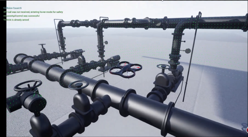
A Digital Twin acts as a dynamic, real-time mirror of the physical environment, constantly updated with real-time data from sensors and IoT devices. For drones, this translates to the creation of a hyper-interactive 3D map of airspace or infrastructure that enables precision navigation and coordination.
“The Digital Twin platform allows for synchronized drone operations, safe navigation through complex airspace, it is like air traffic control for drones—but smarter,” says Prof. Cheng. “It lets us visualize, simulate, and manage drones, airspace, and structures in the ways we never could before.”
Swarms in Sync
One standout application of the technology is the coordination of drone swarms. Imagine hundreds of drones executing a flawless light show, or a bustling city skyline filled with delivery drones and AeroRelief rescue drones—each drone is guided seamlessly by the Digital Twin. This sophisticated platform orchestrates drone movement like a maestro, feeding real-time data into a central system to ensure seamless coordination, preventing collisions, and enabling drones to perform complex manoeuvres safely and smoothly.

Safety First: Dynamic Airspace Control
Apart from coordination, the technology also tackles critical airspace safety challenges. It helps the government establish no-fly zones dynamically, reroute drones during emergencies, and even compel unauthorized drones to land. This is particularly vital in urban settings where drones must navigate in densely populated areas.
“It is like having air traffic control for drones,” Prof. Cheng explains. “We are not just reacting—we’re anticipating risks.”
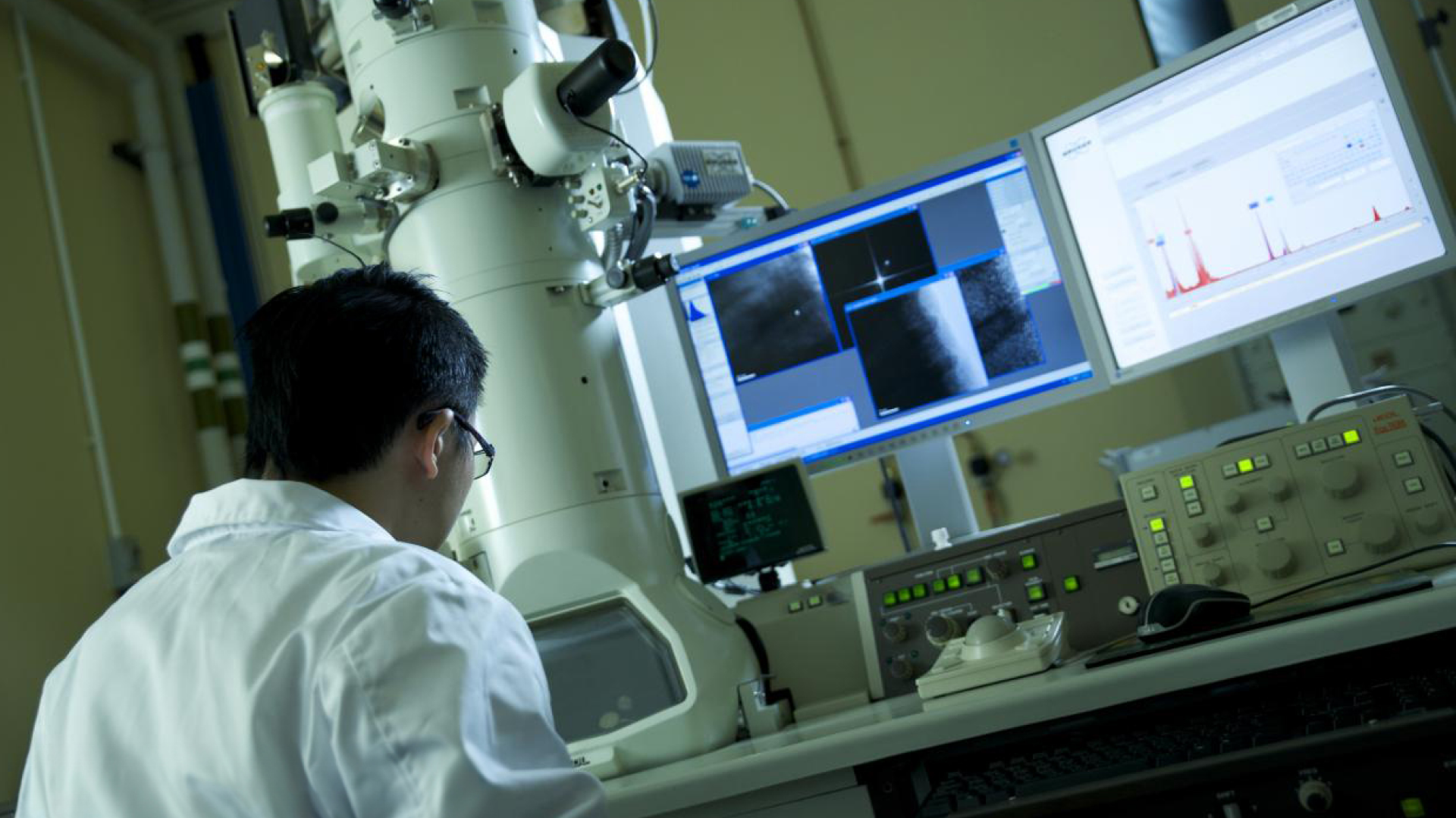
Beyond airspace management, the impact of Digital Twin technology is also transforming infrastructure monitoring. Equipped with high-resolution sensors, drones scan bridges, skyscrapers and industrial plants, as well as detect cracks, loose screws, or other weaknesses by comparing real-world conditions with the Digital Twin model. An impressive of 95% accuracy in detecting defects makes inspections faster, safer, and more reliable, reducing the need for manual checks in precarious or hard-to-reach areas.

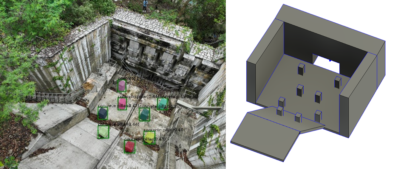
Even HKUST’s entire campus has already been digitally twinned. By integrating data from IoT sensors, cameras, and building systems, the HKUST Digital Twin creates a fully interactive digital environment. This allows for real-time monitoring and seamless interaction between different systems, paving the way for smarter and safer infrastructure management.

The Buzz Around LAERC
At the heart of HKUST’s bold vision is the LAERC, a dynamic hub that transforms cutting-edge research into real-world breakthroughs for the fast-growing low-altitude economy. To ensure innovation soar safely, HKUST participates in HKSAR Government’s Regulatory Sandbox Pilot Projects. These controlled environments allow drone technologies and air traffic systems to be tested in a secure yet flexible space. The sandbox refines innovation while earning public trust and tackling urban challenges like drone noise and seamless integration.
“With our interdisciplinary approach, we are not just building technology—we are ensuring it can truly take flight,” says Prof. Cheng.
Looking Ahead: The Future is Bright
The potential applications of HKUST’s initiatives are nothing short of astounding. The LAERC is developing 3D digital models of urban infrastructure to optimize flying zones and investigating drone noise to facilitate coexistence in city life.
The Future is Elevated
As the low-altitude economy prepares for take-off, HKUST is at the helm. From emergency response to urban logistics, the applications are limitless. Buckle up: The next era of urban mobility is here, and HKUST is leading the ascent.
Sign Up for Our Latest News
Latest News
The Hong Kong University of Science and Technology (HKUST) Jockey Club Institute for Advanced Study will host a Nobel Symposium on February 6, 2026 (Friday), featuring three Nobel Laureates in Physics, along with Prof. Paul C. W. CHU, HKUST President Emeritus and University Professor Emeritus, who is a physicist pioneering in high-temperature superconductivity.
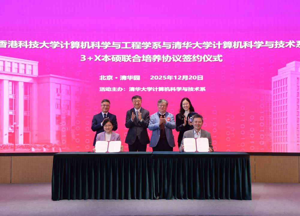
The Department of Computer Science and Engineering (CSE) at The Hong Kong University of Science and Technology (HKUST) and the Department of Computer Science and Technology at Tsinghua University (Tsinghua) announced the launch of a pioneering "3+1+X" Joint Undergraduate – Postgraduate Training Program, set to begin in the 2026/27 academic year.
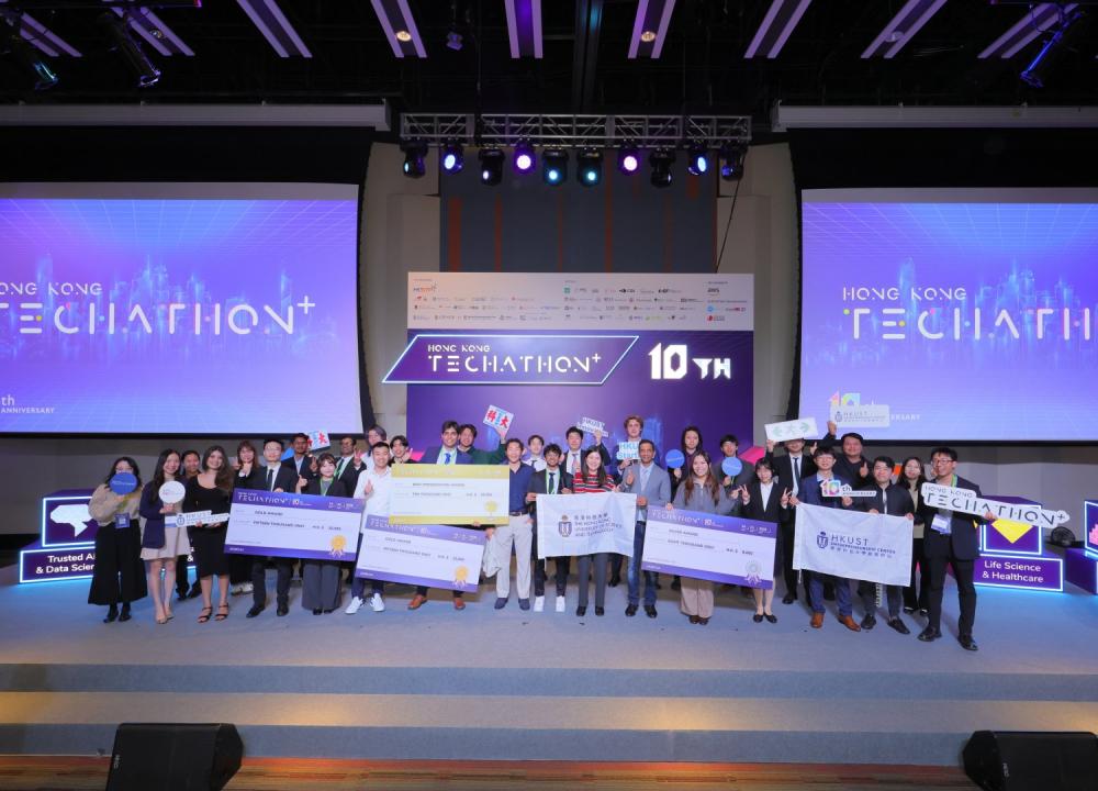
16 teams from HKUST showcased their innovative prowess at the Hong Kong Techathon 2026, jointly organized by HKSTP and 15 leading universities and institutions in Hong Kong. Remarkably, these teams secured 17 out of 46 awards, including the Best Presentation Award, three Gold Awards, five Silver Awards, four Bronze Awards, and four Merit Awards.